✕


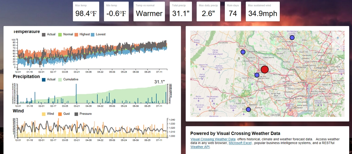
Deliver the power of weather and climate analysis to your business intelligence analysts.
Learn more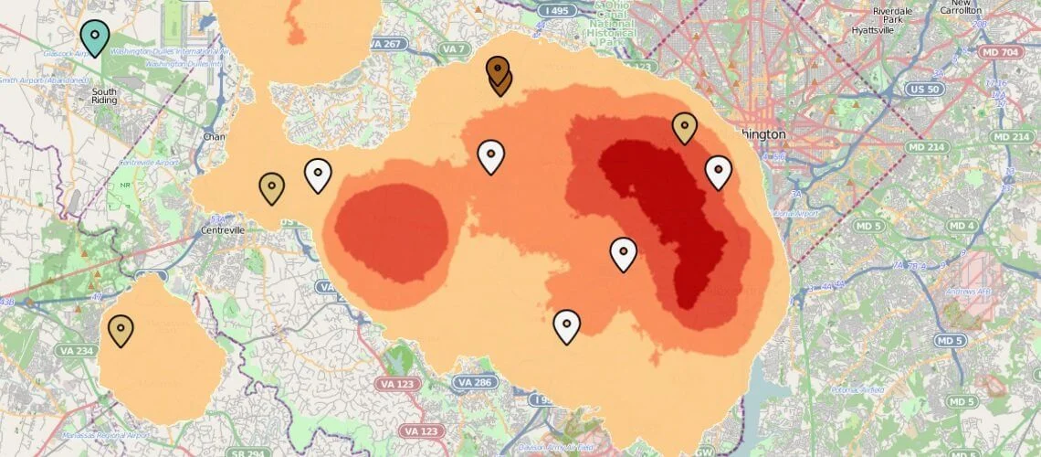
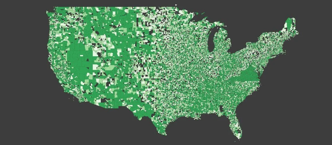
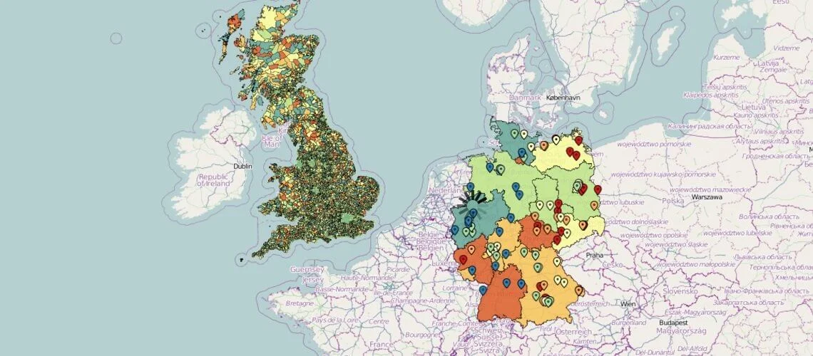
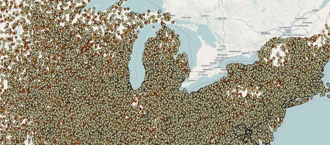
Visual Crossing 4 contains the fastest map rendering engine available. The architecture enables Visual Crossing customers to render hundreds of thousands of complex, thematically sequenced polygons in just seconds. They enjoy the capability to put their entire enterprise onto the maps they create. The expensive and complex geospatial GIS architectures simply cannot compete.
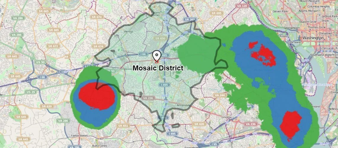
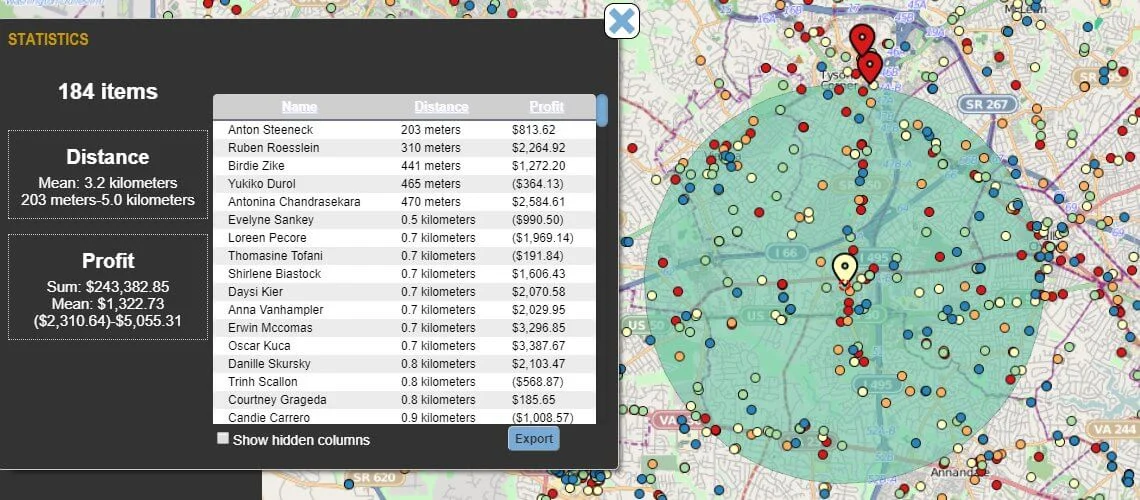
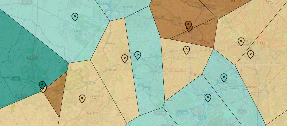
Visual Crossing comes out of the box with a powerful selection capability that is simply not offered in other systems. Users can compare the performance of any location by using selections, radius, drive-time, Voronoi partitions and more. Visual Crossing comes complete with a Location Analysis tool that will help customers understand how locations are performing, locate customers, manage supply chains, monitor competitors and evaluate cannibalization scenarios.
Visual Crossing was designed to be the most intuitive and comprehensive geographic maps platform for business users. Whether you are using SAP or MicroStrategy managing terabytes of data with advanced Business Intelligence capabilities, Visual Crossing creates maps to improve your business analysis.
Visual Crossing 4 offers a client-side, web-architected platform that was designed to have a high technical ceiling to accomplish all of the traditional geospatial analysis while maintaining an easy-to-adopt visualization interface and adding real business value through geo-analytics.


Understand the value and performance of any location

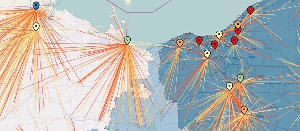
Set data in motion to see trends or campaign results

Instant rendering of your largest datasets

Show your custom territories as they were designed

Intuitive interface for all users to analyze geodata

Manage data and users in a secure environment
© 2026 Bixpert. All Rights Reserved.


